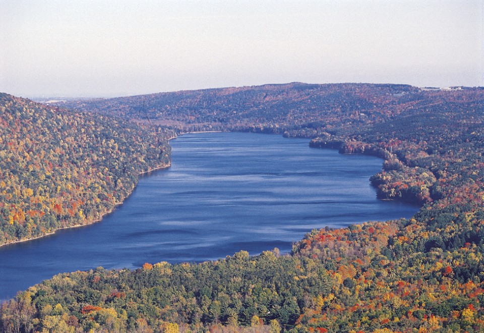
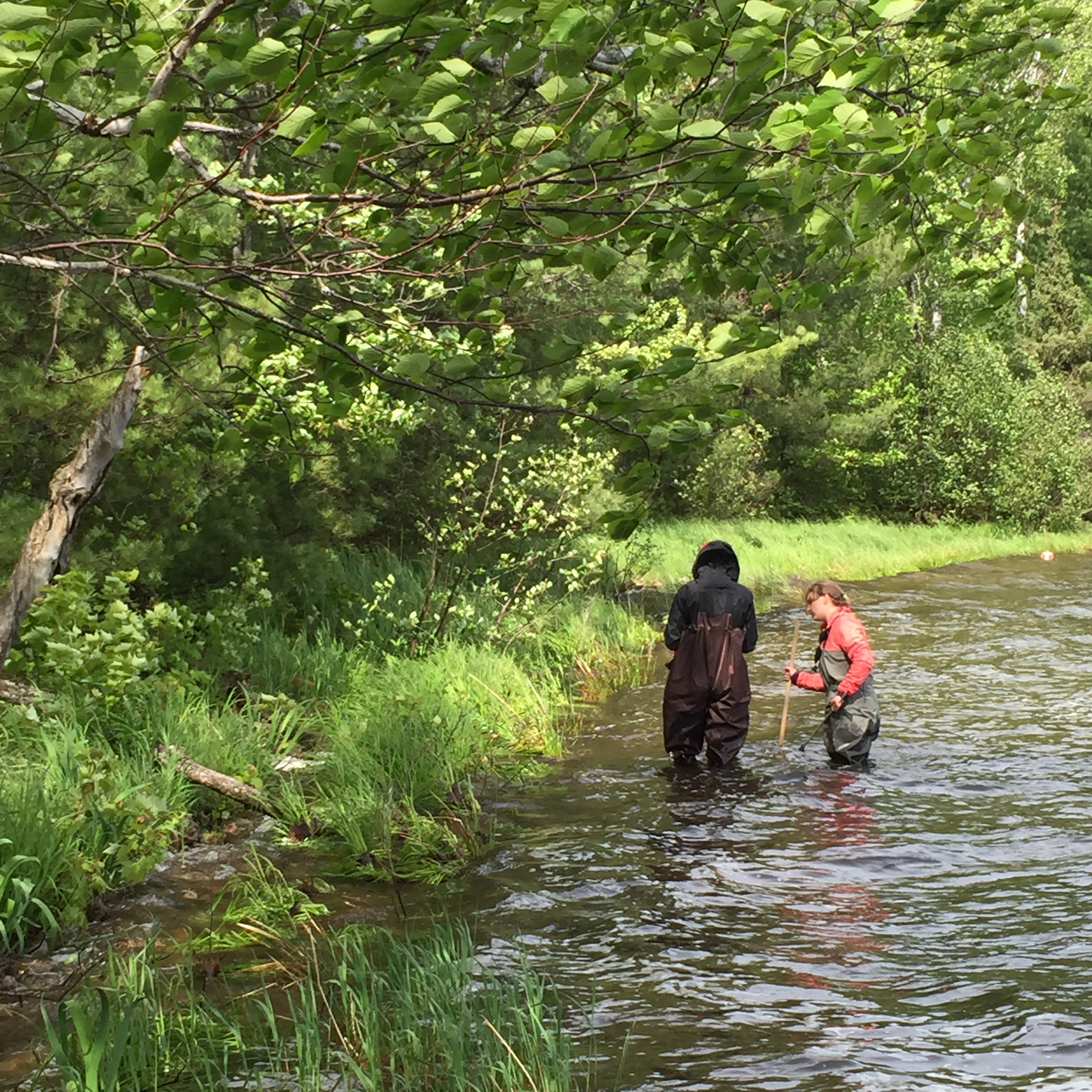
Thompson and Rogers: Global Warming Threatens Lake Trout

Thunder Bay News:

Warming water from climate change is beginning to encroach on the habitat of Northwestern Ontario’s cold water fish. Research conducted at the Experimental Lakes Area shows the region’s temperature has warmed 0.4 C over each of the last five decades. Shorter winters are heating surface water and delaying lake trout spawning.

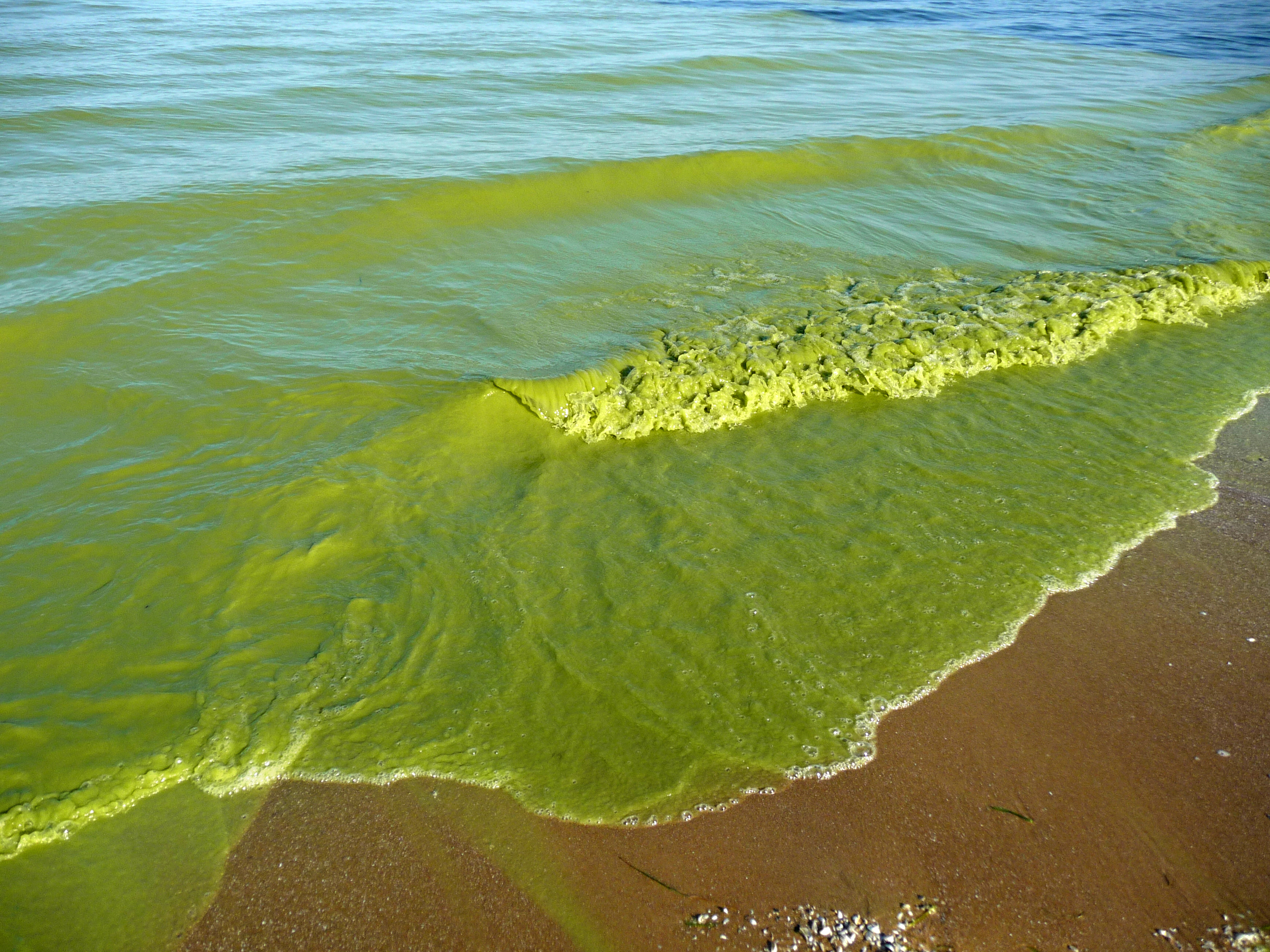
The runoff from increasing summer rain is causing a tea-like discolouration, affecting the water’s heat distribution and compounding the change. Added together, fish biologist Lee Hrenchuk can see consequences for aquatic ecosystems beginning to show.

“The average size of an adult fish has been decreasing over time and we’re seeing this mostly in the cold water fish species that are really dependent on having good spring periods and good fall periods where they can do a lot of eating,” Hrenchuk said.

Jim Erickson: Voluntary Actions May Not Solve Lake Erie's Pollution Problem

University of Michigan:

Large-scale changes to agricultural practices will be required to meet the goal of reducing levels of algae-promoting phosphorus in Lake Erie by 40 percent, a new University of Michigan-led, multi-institution computer modeling study concludes.

The main driver of the harmful algal blooms is elevated phosphorus from watersheds draining to Lake Erie’s western basin, particularly from the heavily agricultural Maumee River watershed. About 85 percent of the phosphorus entering Lake Erie from the Maumee River comes from farm fertilizers and manure.

The new study, which integrates results from six modeling teams, was released today by the U-M Water Center. It concludes that meeting the 40-percent reduction target will require widespread use of strong fertilizer-management practices, significant conversion of cropland to grassland and more targeted conservation efforts.

”Our results suggest that for most of the scenarios we tested, it will not be possible to achieve the new target nutrient loads without very significant, large-scale implementation of these agricultural practices,” said U-M aquatic ecologist Don Scavia, lead author of the new study and director of the Graham Sustainability Institute.

You can ask farmers to help, you can pay farmers to help, you can tell farmers to help, or is there another way? 

Scott Johnson: Monarchs at Peril

ArsTechnica:

Monarch butterflies could disappear from Eastern US within 20 years. As population declines, the prognosis is not encouraging.

In colder climes, signs of spring can lift a heavy weight from a tired, frozen spirit. Trees bud, flowers bloom, and migratory species trickle in to announce the approach of summer. In the US, one of those species is a floppy orange gem: the monarch butterfly. These insects winter in amazingly dense clusters in Mexican forests before making a staggeringly long journey (one that spans multiple generations, in fact) to summer homes to the north.

But in recent years, the population of monarchs that stay east of the Rockies has dropped like a rock. Precise population numbers are difficult to come by, but estimates kept by the US Fish and Wildlife Service show about an 80 percent decline over the last decade.

Ross Andersen: Insight from Lake Sediment

Atlantic:

On a spring morning in New Hampshire, 2,000 years ago, sunlight struck a black cherry tree, opening its white-and-yellow blossoms. As the tree swayed gently in breeze, spiky, spherical pollen grains spilled out of its flowers, and floated up through the limbs and leaves of the canopy, before drifting down to the still surface of a nearby lake. Cool water stalled the pollen’s descent, but still, it kept falling, riding the currents all the way to the lake’s bottom, where it mixed with silt and slowly hardened into sediment.

Time piled new layers of mud and soil atop the pollen, pushing it deeper into the Earth. For two millennia, it continued to sink at that geologic pace, until suddenly, and with some violence, it was slurped up to the surface, through an aluminum tube.

Sitting on a floating platform, a small team of scientists pulled the pollen up as part of a cylinder of sediment, a core bored out of the lake bottom. A core looks like nothing more than a cross-section of muck, but each of its sedimentary slices is an archive, packed with fragments of sticks and leaves, charred remains of wood—and enough pollen grains to census the trees that once surrounded the lake.

Kevin Duffy: Rare Orchid Threatened with Global Warming

Great Lakes Echo:

Cypripedium_candidum.jpg
As climate change threatens wet landscapes with persistent and intense droughts, natural resource managers look for ways to preserve the remaining habitats of the rare species that dwell in them.

It’s not easy. “There’s a big problem with managing climate sensitive species,” said Sue Galatowitsch, professor of fisheries, wildlife and conservation biology at the University of Minnesota.

That problem – the uncertainty of the future climate – was the focus of a recent study of how best to protect a rare orchid in Minnesota called the small white lady’s slipper.

“Management of very specific, local sites is important because conservation is really a boots on the ground effort,” Galatowitsch said. State plans guide policy, but day-to-day decision-making usually happens one place or person at a time.

Nathan Collins: Models Often Better Than Guessing

Pacific Standard:

“We pitted University students in introductory environmental science courses against the models and found that even when the models were completely wrong they still on average made better decisions than the humans did,” Holden writes, perhaps because the models force environmental managers to think more clearly about their assumptions. “Without the aid of modeling, decision maker assumptions become less transparent, and it is easier for them to make biased decisions.”

Eric Anondson: MN Distressed Communities

streets.mn:

This is really fascinating to see visually and might even fit with many assumptions of what particular areas of the metro area are like. Go mouse around the interactive map at the link above, the zip codes reveal the statistics for each zip code.

But I had one particular issue that I couldn’t shake. The zip code map of Minnesota’s distressed communities had a worrying similarity with another map I posted about a few weeks ago. The Minnesota Carbon Donut. I immediately thought of the famous XKCD comic on heat maps. The map of economic distress correlates quite closely with the carbon footprint ring. Huh? I’m going to have to dwell on that a bit more, but I think how closely they match up deserves some attention.

Erica Goode: Non-Native Species Aren’t Always Unwanted

New York Times:

Dr. Thompson and other scientists have called for a more nuanced approach to evaluating whether the presence of a species is harmful or beneficial. Eradicating most invasive species is virtually impossible in an era of globalization, they note. And as climate change pushes more species out of their home ranges and into new areas, the number of so-called invaders is likely to multiply exponentially.

Yet the notion that a species should not be judged on its origins is highly controversial, as Mark Davis, a biology professor at Macalester College in Minnesota, discovered when he and 18 other researchers submitted an article in 2011 saying just that in the journal Nature...

But in the five years since that contentious exchange, the idea that invasive species should be assumed guilty until proven innocent has begun to wane, the shift prompted in part, Dr. Davis speculated, by concerns over the use of chemical pesticides and the disruption of landscapes caused by many eradication efforts.

See this blog article


Nathaniel Rich: DuPont's Sin and Rob Bilott's Courage

New York Times:

Just months before Rob Bilott made partner at Taft Stettinius & Hollister, he received a call on his direct line from a cattle farmer. The farmer, Wilbur Tennant of Parkersburg, W.Va., said that his cows were dying left and right. He believed that the DuPont chemical company, which until recently operated a site in Parkersburg that is more than 35 times the size of the Pentagon, was responsible. Tennant had tried to seek help locally, he said, but DuPont just about owned the entire town. He had been spurned not only by Parkersburg’s lawyers but also by its politicians, journalists, doctors and veterinarians. The farmer was angry and spoke in a heavy Appalachian accent. Bilott struggled to make sense of everything he was saying. He might have hung up had Tennant not blurted out the name of Bilott’s grandmother, Alma Holland White.

White had lived in Vienna, a northern suburb of Parkersburg, and as a child, Bilott often visited her in the summers. In 1973 she brought him to the cattle farm belonging to the Tennants’ neighbors, the Grahams, with whom White was friendly. Bilott spent the weekend riding horses, milking cows and watching Secretariat win the Triple Crown on TV. He was 7 years old. The visit to the Grahams’ farm was one of his happiest childhood memories.

When the Grahams heard in 1998 that Wilbur Tennant was looking for legal help, they remembered Bilott, White’s grandson, who had grown up to become an environmental lawyer. They did not understand, however, that Bilott was not the right kind of environmental lawyer. He did not represent plaintiffs or private citizens. Like the other 200 lawyers at Taft, a firm founded in 1885 and tied historically to the family of President William Howard Taft, Bilott worked almost exclusively for large corporate clients. His specialty was defending chemical companies. Several times, Bilott had even worked on cases with DuPont lawyers. Nevertheless, as a favor to his grandmother, he agreed to meet the farmer. ‘‘It just felt like the right thing to do,’’ he says today. ‘‘I felt a connection to those folks.’’

Natalie Wolchover: Longer Time to Recover is a Warning Sign

Atlantic:

Systems that exhibit such “critical transitions” tend to be so complicated and riddled with feedback loops that experts cannot hope to calculate in advance where their tipping points lie—or how much additional tampering they can withstand before snapping irrevocably into a new state.

At Peter Lake, though, Carpenter and his team saw the critical transition coming. Rowing from trap to trap counting wriggling minnows and harvesting other data every day for three summers, the researchers captured the first field evidence of an early-warning signal that is theorized to arise in many complex systems as they drift toward their unknown points of no return.

The signal, a phenomenon called “critical slowing down,” is a lengthening of the time that a system takes to recover from small disturbances, such as a disease that reduces the minnow population, in the vicinity of a critical transition. It occurs because a system’s internal stabilizing forces—whatever they might be—become weaker near the point at which they suddenly propel the system toward a different state.

John Myers: Lakes Warming Up

Duluth News Tribune:

Lakes across the globe are warming faster than oceans and air temperatures in a sign that climate change may be affecting freshwater environments more than anyone had previously understood.

That’s the finding of a report published in the journal Geophysical Research Letters and announced Wednesday at the fall meeting of the American Geophysical Union. The study found lakes worldwide warmed an average of 0.61 degrees Fahrenheit per decade between 1985 and 2009.

In northern climates, that increase averaged 1.3 degrees per decade. “The world’s deepest ice-covered lakes warmed twice as fast as the overlying air temperatures,” the report notes.

Temperature is among the most basic factors in lake ecosystems, the study’s authors noted, and when “the temperature swings quickly and widely from the norm, life-forms in a lake can change dramatically and even disappear.”

How long will some people keep their head in the sand? Justice would be served if only those descendants of today's global warming deniers paid the costs of inaction.

How to Simulate the Future of a Watershed

University of Wisconsin: Water Sustainability and Climate

Using a tool similar to a computer game, Melissa Motew is peering into the future. Motew is a modeler. She uses computers and mathematics to simulate ecosystems and make sense of nature.

Her task is to shed light on what the Madison area’s environment could be like by the year 2070 and what this might mean for human well-being—how much food could we grow, how well could the land withstand floods and will we have clean lakes yet?

“We want to track what’s happening through time, so we can understand all of the changes,” says Motew.

The steps the article outlines are helpful: (1)start with stories, (2)simulate the system, and (3)ask what-if questions.

Sarah Booth: Zoning for Sustainability

Sustainable City Network:

In a study of 32 cities of various sizes, University of Wisconsin Professor Anna Haines found that most city zoning ordinances had little support for sustainable development. Large or small, coastal or central, most of the communities studied by Haines and her colleague Edward Jepson didn’t have much in their regulations that was useful for supporting sustainability principles. This isn’t surprising, since most of the ordinances were written long before sustainability became a household word.

“The city that I live in wrote their code in 1979,” Haines said, so it’s not very surprising that it doesn’t address sprawl, peak oil, floodwater control or other contemporary concerns.
“Almost 100 years ago is when the first zoning codes were put in place — New York City was the first,” she said. “And at that time the purpose was to strictly separate uses, to separate industry from housing, which made a lot of sense at the time, but doesn’t so much anymore.”

Haines’ study began by identifying nine principles of sustainability:
1. Encourage higher-density development.
2. Encourage mixed use.
3. Encourage local food production.
4. Protect ecosystems and natural functions.
5. Encourage transportation alternatives.
6. Preserve/create a sense of place.
7. Increase housing diversity and affordability.
8. Reduce the use of fossil fuels/encourage the use of fossil fuel alternatives.
9. Encourage the use of industrial by-products.

There has been a big lag in revising zoning ordinances for sustainability and walkability.

Reduce Variability At Your Peril

UW-Madison Center for Limnology:

We want robust harvests of crops, fish and fuel year after year. As a result, we try to manage the use of our resources in a way that minimizes their variability. We seek a predictable “status quo.”

But a new study says that managing our environment for predictable outcomes is risky. In fact, more often than not, it backfires...

[Dr.] Carpenter and his colleagues ran a series of simple computer models looking at three human endeavors – controlling nutrient pollution in lakes, maintaining cattle production on rangelands invaded by shrubs, and sustaining harvest in a fishery.

In all cases, when they tried to control variance – by tightly controlling fish harvest or shrubs in grasslands, for example – unexpected outcomes occurred. Fish stocks collapsed at lower harvest levels. Grasslands were replaced by shrubs with even light pressure from cattle grazing.

The results are counter-intuitive. How can reduced pressure on a resource end up being bad for business? Part of the explanation, Carpenter says, is that, “the minute humans try to manage the system, they become part of the system.” And our involvement may help explain some of these unintended outcomes.

“Living systems need a certain amount of stress,” Carpenter says, noting that, as they evolved “they continually got calibrated against variability.” Just as our immune systems rely on exposure to bacteria and viruses to sharpen their skills at responding to disease, natural systems also need that kind of stimulation.

Are there examples in your area? The building of levees for flood control in the article resonates. How about the Mille Lacs walleye population? 

Linda Poon: Putting Citizens at the Center of Urban Design

CityLab:

Creating a lively public space isn’t as easy as building it and waiting for the crowds to come. There’s a lot that city planners have to consider: How much space is available? What’s the target demographic? How can a public space be made energy efficient?

A group of researchers at MIT thinks that there’s an important piece of the puzzle that’s too often overlooked: the human experience. Studying how people interact with cars, buildings, and sidewalks within an urban space says a lot about its quality, says Elizabeth Christoforetti, an urban and architectural designer at MIT Media Lab.

With a $35,000 grant from the Knight Prototype Fund, she and her team are working on a project called Placelet, which will track how pedestrians move through a particular space. They’re developing a network of sensors that will track the scale and speed of pedestrians, as well as vehicles, over long periods of time. The sensors, which they are currently testing in downtown Boston, will also track the “sensory experience” by recording the noise level and air quality of that space.

In the tradition of observations of William Whyte.

NASA: Less Algae, Not Clear Water, Keeps A Lake Blue

Lake Tahoe’s iconic blueness is more strongly related to the lake’s algal concentration than to its clarity, according to research in “Tahoe: State of the Lake Report 2015,” released today by the Tahoe Environmental Research Center (TERC) of the University of California, Davis. The lower the algal concentration, the bluer the lake.

Data from a research buoy in the lake, owned and operated by NASA’s Jet Propulsion Laboratory, Pasadena, California, enabled Shohei Watanabe, a postdoctoral researcher at TERC, to create a Blueness Index that quantified Lake Tahoe’s color for the first time.

The assumption that lake clarity is tied to blueness has driven advocacy and management efforts in the Lake Tahoe Basin for decades. But Watanabe’s research showed that at times of the year when the lake’s clarity increases, its blueness decreases, and vice versa.

Watanabe combined the blueness measurements with data on clarity. Clarity is measured by observing the depth at which a dinner-plate-sized white disk remains visible when lowered into the water. He was surprised to find that blueness and clarity did not correspond. In fact, they varied in opposite directions.

This is due to seasonal interplay among sediment, algae and nutrients in the lake. Clarity is controlled by sediment. Blueness is controlled by algal concentration, which in turn is controlled by the level of nutrients available to the algae.

AnnaKay Kruger: A Lake's Woody Habitat

UW: Center for Limnology:

Michaela Kromrey clips herself into her bulky waders, fitting the straps over her shoulders and sealing herself into their protective rubber lining. We’ve dropped anchor near the shore of Jute Lake, and waves whip the side of the boat vigorously in the high wind. It’s a beautiful day, utterly devoid of cloud cover, but the wind is sharp and swift over the water, forcing us to don our sweatshirts and windbreakers to stave off the chill. Michaela and I, both UW-Madison undergraduates, wait in the boat while Ellen Albright, a student at Minnesota’s Macalester College, wades along the shoreline, dragging a tape-measure behind her.

Lisa Palmer: Genetically Modified Mosquitos

Yale Environment 360:

When people think of genetically modified organisms, food crops like GM corn and soybeans usually come to mind. But engineering more complex living things is now possible, and the controversy surrounding genetic modification has now spread to the lowly mosquito, which is being genetically engineered to control mosquito-borne illnesses.

A U.K.-based company, Oxitec, has altered two genes in the Aedes aegypti mosquito so that when modified males breed with wild females, the offspring inherit a lethal gene and die in the larval stage. The state agency that controls mosquitos in the Florida Keys is awaiting approval from the federal government of a trial release of Oxitec’s genetically modified mosquitos to prevent a recurrence of a dengue fever outbreak. But some people in the Keys and elsewhere are up in arms, with more than 155,000 signing a petition opposing the trial of genetically engineered mosquitoes in a small area of 400 households next to Key West.

Tinkering with Nature can have unintended consequences. See Nassim Nicholas Taleb's concerns with GMOs:

The Precautionary Principle with Application to the Genetic Modification of Organisms

EconTalk Episode with Nassim Nicholas Taleb; Hosted by Russ Roberts

Greg Seitz: Unlocking Lake of the Woods

St. Croix Watershed Research Station Blog:

low-tp-load-rainy-river-1960-2010-hargan-et-al-2011-jglr-fig-4b.jpg
Lake of the Woods is the vast body of water that makes up most of the spur on Minnesota’s northern border. Sprawled across the U.S.-Canada border, it is 70 miles north-south and 60 miles east-west, contains more than 14,552 islands, and boasts 65,000 miles of shoreline. It is the size of Rhode Island and a good candidate as the “sixth Great Lake.”

Like Lake Erie and other Great Lakes, Lake of the Woods is also plagued by harmful algal blooms. Even after nutrient pollution was reduced, Lake of the Woods seems to keep getting greener.

Enormous amounts of waste discharged from paper mills on the Rainy River poured into the lake for decades, carrying phosphorus, which fed the algae. City wastewater also went straight into the river. After the Clean Water Act was passed in 1972, the waste discharges were significantly lowered and the overall cleanliness of the water entering the lake was improved.

Jed Kolko: How Suburban Are Big American Cities?

FiveThirtyEight:

Our analysis showed that the single best predictor of whether someone said his or her area was urban, suburban or rural was ZIP code density. Residents of ZIP codes with more than 2,213 households per square mile typically described their area as urban. Residents of neighborhoods with 102 to 2,213 households per square mile typically called their area suburban. In ZIP codes with fewer than 102 households per square mile, residents typically said they lived in a rural area.2 The density cutoff we found between urban and suburban — 2,213 households per square mile — is roughly equal to the density of ZIP codes 22046 (Falls Church in Northern Virginia); 91367 (Woodland Hills in California’s San Fernando Valley); and 07666 (Teaneck, New Jersey).

Other factors played minor roles in predicting how respondents described where they live. Residents of very small cities and towns rarely said they lived in an urban area, even if their neighborhood was quite dense. Residents of lower-income neighborhoods with older housing stock often said they lived in an urban area, even if it was lower-density. Residents of lower-density ZIP codes with lots of businesses sometimes called their neighborhoods urban; so did residents of lower-density, higher-income ZIP codes that are next to higher-density ZIP codes. But, in general, ZIP code density alone gets us most of the way to predicting whether people say they live in an urban, suburban or rural area.

Density makes a place vibrant. Density makes a city work. Density is the word and our answer to make better communities. Holly Whyte said "we are going to have to work with a much tighter pattern of spaces and development, and that our environment may be the better for it." 

We need to confront the need for density. I've denied and deluded myself that density was not the main issue. I've used words like 'compact', 'vibrant', and 'urban'. What is meant is more people per unit area, as well as mixed use and class. 

Higher density is better for a city. Again, Holly Whyte:

Density also has an important bearing on the look and feel of a neighborhood. If it is urban it ought to be urban. Most of our redevelopment projects are too loose in fabric. They would look better, as well as being more economical, if the scale were tighten up... concentration is the genius of the city, its reason for being. What it needs is not less people, but more, and if this means more density we have no need to feel guilty about it. The ultimate justification for building to higher densities is not that it is more efficient in land costs, but that is can make a better city.
— Holly Whyte - The Last Landscape